The coronavirus lockdown means that I have more time to look through photos from past rides. This particular ride was done in April 2015, in the week after Easter (and I believe there wasn’t any other club Easter trip that year).
According to Edmund, we didn’t start on Good Friday because my Dad was expressing some interest in coming along, but he wasn’t able to start on Good Friday (I think he had to mark assignments). As it happened, he didn’t end up coming at all. Unfortunately, the result was that only 3 of us were able to go (Edmund, John Harland, and myself); for us, unlike many other club members, we didn’t have any inconvenient commitments like work over the week after Easter (it was a University holiday, lucky me).
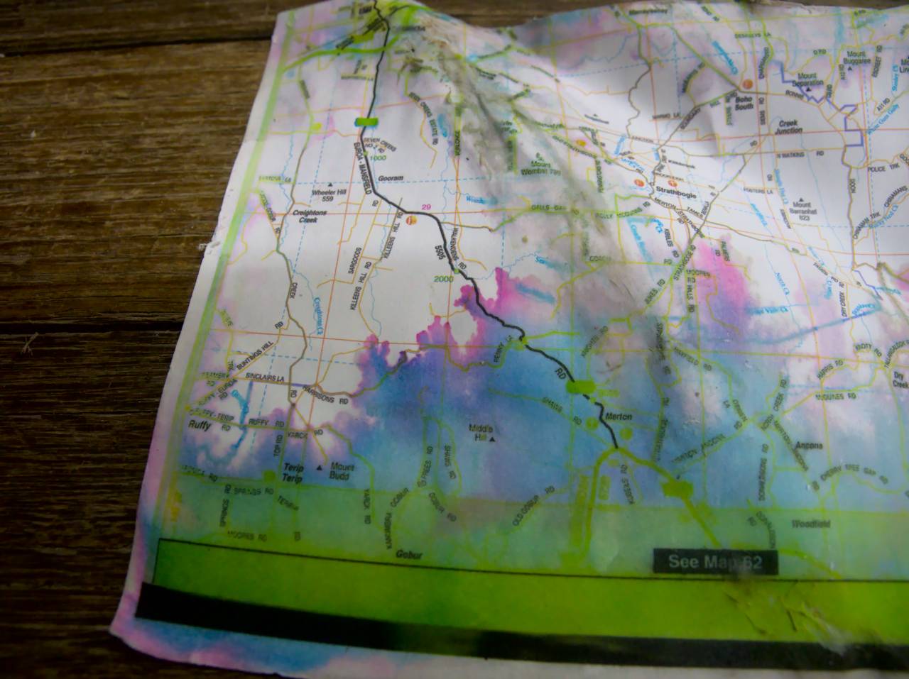
The plan that I’d come up with was to start at Euroa, spend the first night at Ruffy, then go to Yea, Molesworth, and Alexandra. After that, the planned route became a tad more adventurous, going via a dot on the map called Rubicon, and across the mountain range via forest roads to get to Warburton. From there it would be an easy run into Lilydale. All up I planned that it would take 5 days.
In many ways, this ride did not go according to plan, although we did at least manage to complete the whole distance, and didn’t run out of time. Edmund has since remarked how sometimes cycle tours can feel like living in a badly written comedy. This was such a tour, and I hope readers appreciate the comedy.
So we caught the train out to Euroa on Easter Monday, and after an obligatory cafe stop we headed out towards Ruffy. Most previous club rides to Ruffy have started from Seymour and gone via the Hughes Creek road, but in planning this trip I had found what looked like a more interesting route. We took a bit of a circuitous route out of Euroa in order to avoid riding on the main road, but we still couldn’t avoid doing about 10 km on the main road that goes to Mansfield. It climbs quite a bit to get over a range of hills between Euroa and Merton, and it was at the very top of the climb where we turned off, on to Penny Lane.
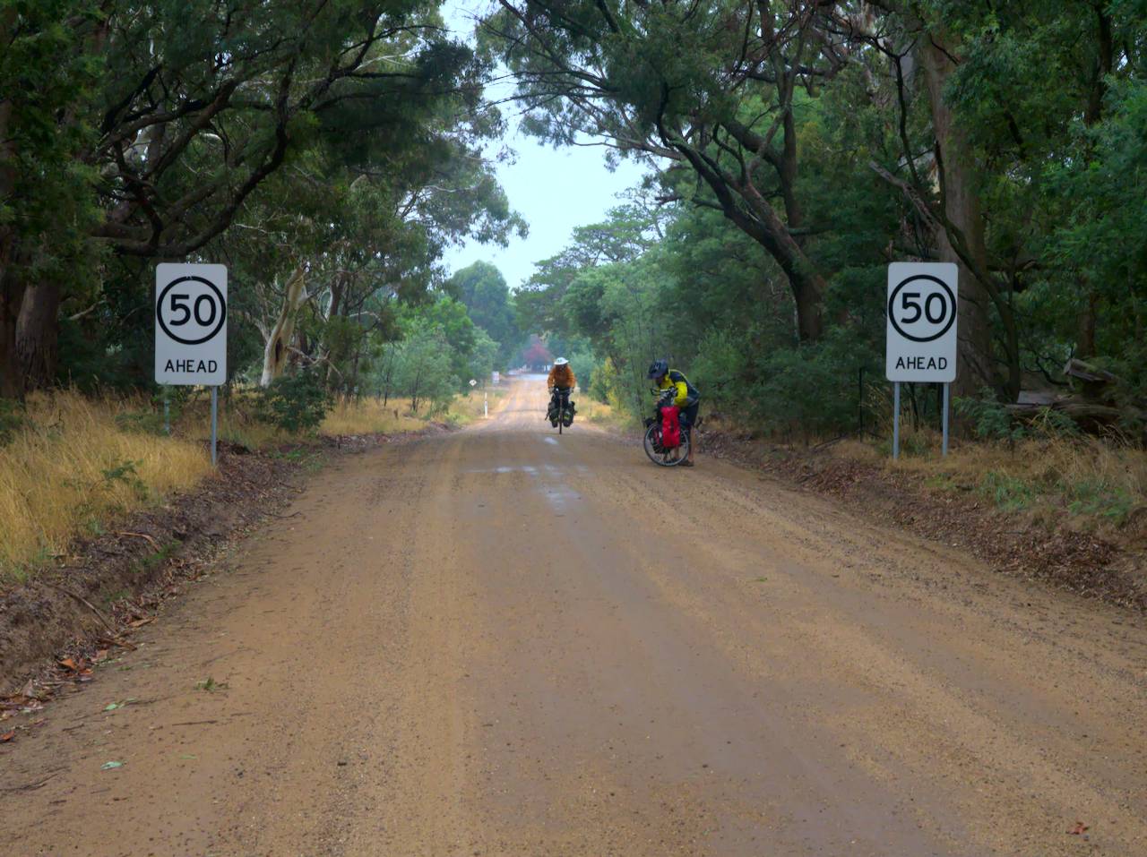
After a roadside lunch near the turn off, we headed on towards Ruffy, and it panned out as I had expected; a good quality dirt road with very little traffic, following the ridge line. Some ups and downs, a little steep in places, but quite ridable.
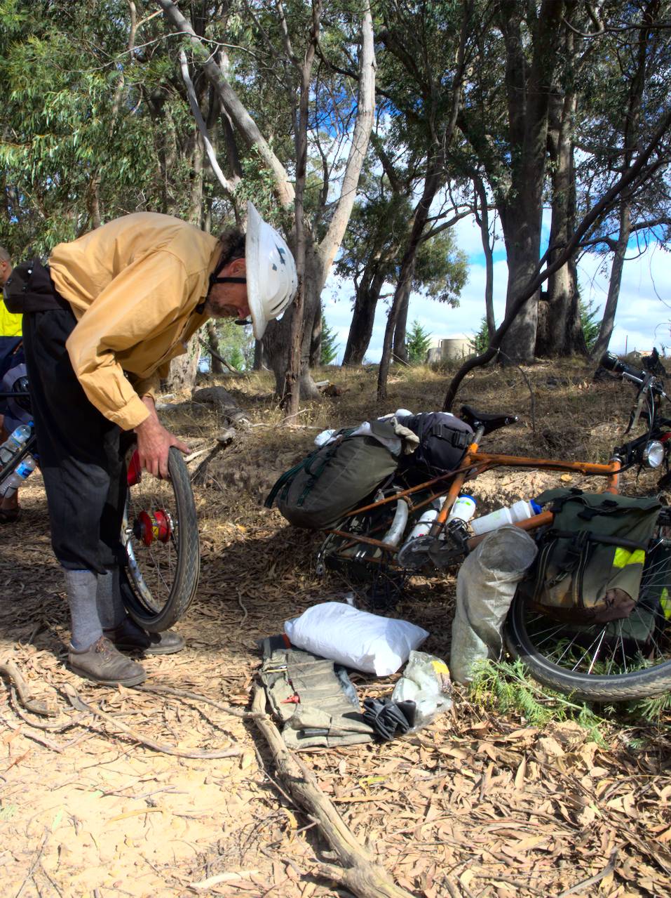
After a few kilometers, Edmund and I stopped near some water tanks at a 90 degree bend in the road to wait for John to catch up. We waited for quite a while, and no sign of John, so we rode back (up a couple of solid hills too) to find John in the process of repairing a puncture.
With John’s tire fixed, we kept going, and seemed to be spending an awful lot of time whizzing down hills. It was certainly a lot of fun.
Eventually we came to a couple of intersections that didn’t really add up with what was depicted on the map. Looking back I’m not sure precisely when the penny dropped, if we checked where we were with modern technology or if we made it all the way to Gobur (a small cluster of houses that was definitely not on the way to Ruffy). But we had gone the wrong way. Since then, I have learned that our mistake was at the water tanks; we turned left, when in fact we should have gone straight ahead, through a gate that looks quite like some farmer’s driveway, but is in fact Penny Lane.
We had not actually made our route too much longer; basically we were doing two sides of the triangle. Unfortunately however, our scenic route meant that we now had to climb up a massive big hill to get to Ruffy.
I believe we got there before the produce store (a cafe that we’ve visited several times) closed, so we enjoyed coffee and cake before going to set up camp.
If my memory is correct, the next day (not being a public holiday) the produce store wasn’t open. This was particularly inconvenient, because it was also raining. Not particularly heavy rain, just steady dripping. And persistent. So we went on our way towards Highlands, and then down the hill to get to Yea. The rain was easing off by lunchtime, but we were still soaked (even with all our wet weather gear the water still got in). We went to a cafe at Yea, and found a table as close to the fire as we could. We spent quite a while in that cafe, warming up.
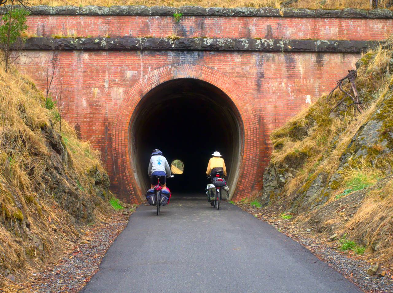
We decided that we didn’t want to spend the night at Yea, so we continued on, along the rail trail to get to Molesworth. The surface was very soft after the rain, which made it slow going on the climb to the Cheviot tunnel, and we ended up going onto the dirt road that runs parallel to that section of trail as it was easier going.
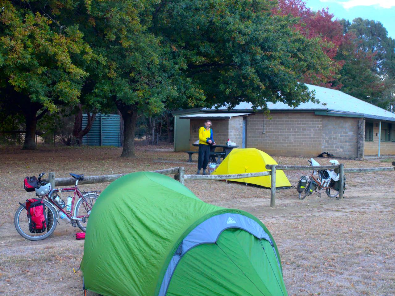
We cooked our dinner at the camp kitchen at Molesworth, and also helped Edmund replace his Rohloff shifter cables, as he was finding it had a strange problem, jamming at certain points. I think the cables had frayed, and it seemed the bits of broken off strands were jamming it.
The next day John split off to cycle back to Melbourne (going through Flowerdale I think, to get to Hurstbridge), because he had commitments to attend to (I can’t remember what). Edmund and I cycled to Alexandra (not on the rail trail; we took a quiet back road instead which would have been faster). Alexandra was the last supply point for the next couple of days, as well as the last cafe.
We headed on towards Thornton where we stopped for lunch (or maybe second lunch). On the way, seeking to avoid the road on the map marked “Goulburn valley highway”, I had noticed an alternative route, so we had a look. It seemed promising at first, a dirt track with absolutely no traffic, but then after about half a kilometer we came round a bend and saw the track going straight up the side of a massive big hill. Edmund and I considered this situation very briefly, then went back to cycle along the highway (which actually wasn’t very busy anyway) the last few kilometers into Thornton.
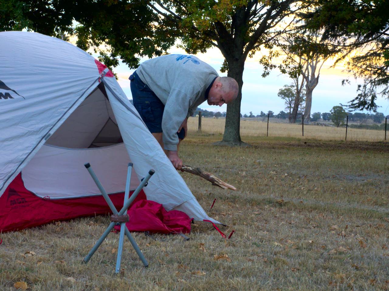
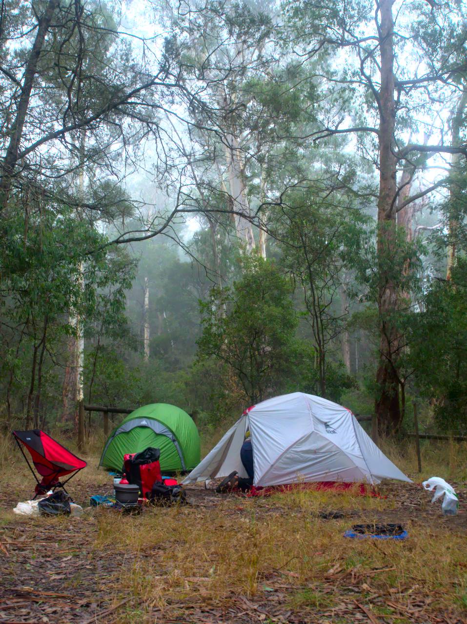
Rubicon is interesting for having one of the earliest hydroelectric schemes in Australia, which I had read about before the trip. We found a suitable spot to camp a few hundred meters from the power station, and it was quite tranquil, perhaps apart from the continuous 50 Hz hum in the background.
Fortunately for us, because the Easter long weekend was over we had the whole place all to ourselves. However, Edmund mentions that he recalls discovering something gruesome left behind by the long weekend campers. I don’t remember that bit.
Although we weren’t camped too close to the road, we weren’t very far away from it either, and Edmund’s tent was closer to the road than mine. At about 6am the next morning, Edmund heard a logging truck in the distance. It came along, and pulled up next to the road, then sat there with it’s engine idling for about half an hour, then drove off. Edmund says that he felt this really added to the bucolic serenity; the 50 Hz hum of the power station, the distant buzz of chainsaws, and finally a logging truck parked right next to his tent. Ah, the serenity.
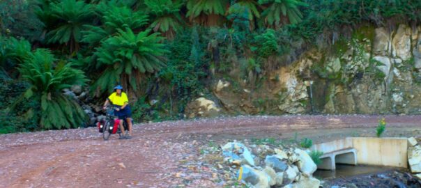
From there, the road we followed went up the valley, roughly alongside the Royston river. Although the road followed the river, it certainly wasn’t flat, climbing at about 10% most of the time (we were, of course, heading upstream). We also started to get the impression that the “Rubicon historic area”, as it was signposted, was more of an indication that the forests around us were soon to be the subject of history, what with the continuous distant buzz of chainsaws, punctuated by the distant crash of falling trees. Logging trucks also went by regularly, though that wasn’t a problem as the road was very wide and we could hear them from a fair way off.
I had been aware that there would be quite a bit of climbing on this route, and I was right; we seemed to be climbing for most of the day. I think it might have been one of those days were we had two lunch stops. As we progressed we went onto other roads that didn’t have logging trucks on them, although the surface was very rocky, consisting of stones not dissimilar to railway ballast. Edmund made the comment that the area had been “visited by the man with the red railway ballast”, referring to the large stones embedded in red clay that we cycled over.
The route that we took skirted around the side of a bunch of contour lines called Mt Bullfight, and then it was mostly down hill to where we were planning to camp for the night, at Big river camp site. When we got there, the road went across a bridge over this very small creek, then there was a sign saying “Big river camping area”, leaving us with the startling impression that the tiny creek was the “Big river”. As it happens, the next morning Edmund was looking around, and he says that just around the corner there was in fact a larger river.
We went into the camping area and discovered that, unfortunately for us, we didn’t have the whole place to ourselves. There was one other family group camped there. We figured that although there might be noise or music, we would camp there anyway, because I didn’t know of any other camping spots nearby and it was getting late in the day. So we set up our tents at a suitable distance from them so that any loud music/conversation etc wouldn’t keep us awake.
Anyway, as we were cooking our dinner, we heard this very loud bang that came from over where they were. The echos reverberated through the forest. We thought it sounded almost like a gunshot. Well, we soon realised that that would be because it was. So, Edmund and I cooked our food and tried to make conversation between gunshots, while the “shooting family” (as we now refer to them) continued with their evening target practice. We considered whether we would pack up our stuff and move somewhere else, but we figured it would be very inconvenient since we were already cooking our dinner, and besides, it was getting dark so the shooting family would have to stop sooner or later. At some point, I’m sure, one of us said “Ah, the serenity”.
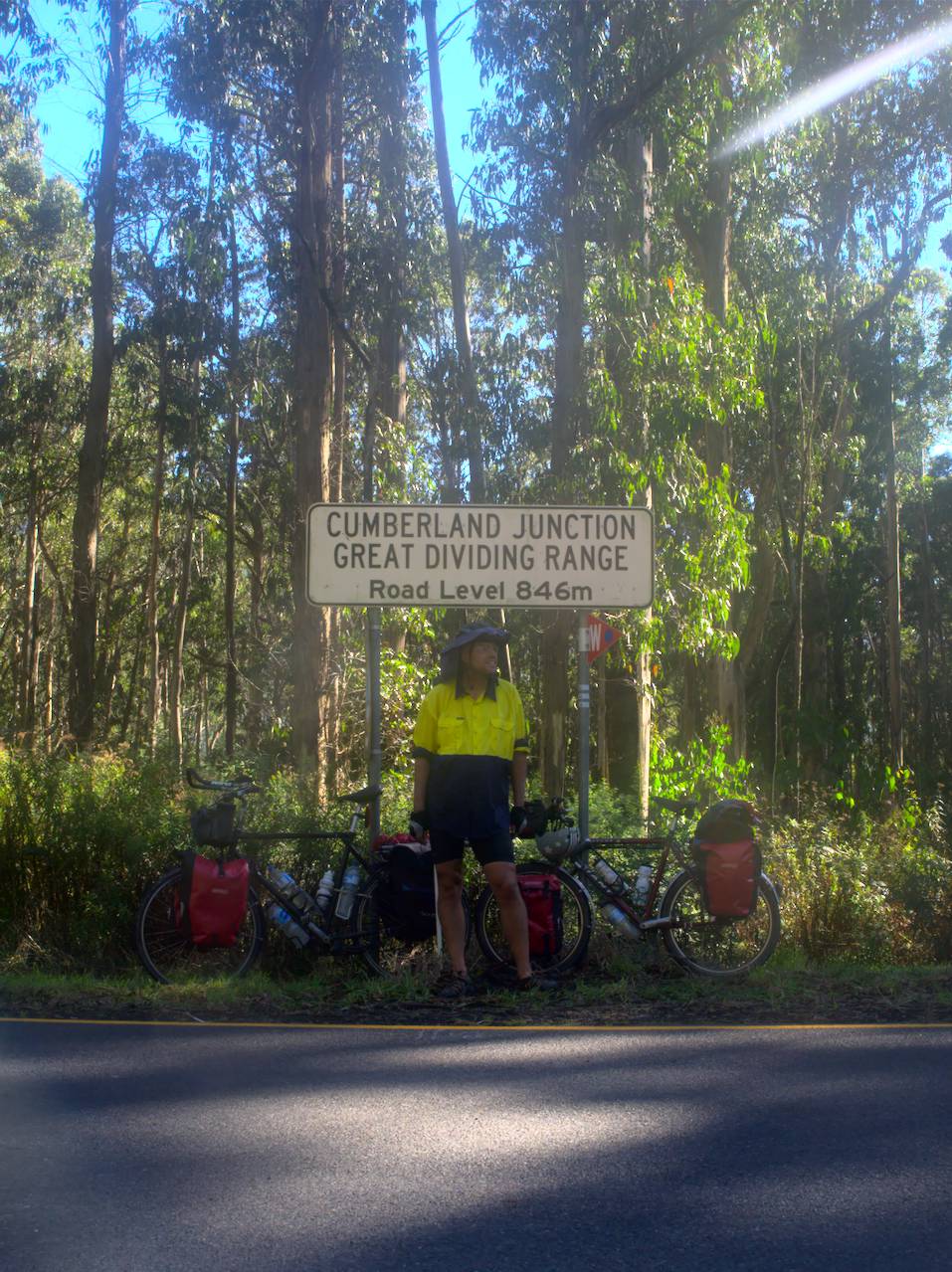
The shooting family’s target practice session did finally come to an end once it started getting dark. The next morning was quite tranquil really (they didn’t get up for an early morning session). We had a good climb out of the Big river valley to get up to Cumberland Junction, then we went down the Reefton spur road which comes out near the Upper Yarra dam, and we made it to Warburton for lunch; also our first cafe stop since Alexandra.
From Warburton, our plan had been for a relaxing uneventful 40 km of rail trail in to Lilydale, but soon after we got on the trail we noticed a couple of ominous signs that this not going to be the case. There was a charity running event being organised on that day. From memory, it was something like run 100 km in support of some particular worthy cause (I don’t remember what the cause was now). It was obviously very popular because there were thousands of people jogging all the way from Milgrove (just out of Warburton) through to Mt Evelyn (a few km from Lilydale), so we rode along dinging our bells almost continuously.
All up it was a memorable trip.
Photos